
Best Apps for Landscape Photography: 6 Apps for Planning Shoots
Do you dream of capturing that perfect landscape photo in the right location, with the right light, and just the right conditions? While you can’t control the weather or the landscape, the right mobile apps can help you plan ahead and greatly increase your chances of being in the right place at the right time.
In this article, I’ll share the apps I recommend for landscape photographers and explain how each one can help you plan your shoots, find great locations, and anticipate the conditions that can make an image truly special. All the apps I will cover are free, except one, and they have dramatically improved my photography planning and I believe they will improve yours as well.

Photopills
The first app is the one that costs money, but it won’t bust your wallet. Photopills is currently $10.99 on the Apple App store and Google Play store and it is a one time payment. Once you’ve paid for the app you have it for life!
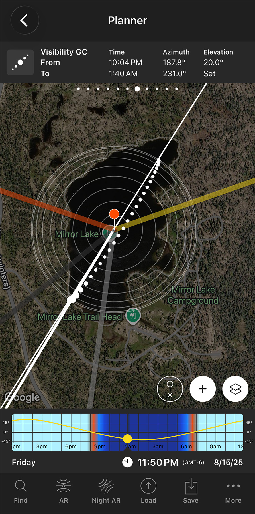
Photopills is one of the most powerful planning apps available for landscape photographers. Its main feature is the Planner, which lets you see exactly where the Sun, Moon, and Milky Way will be in relation to a location at a specific date and time. This makes it especially useful for planning sunrise and sunset compositions, moon alignments, Milky Way shots, and other challenging images before you ever leave your home.
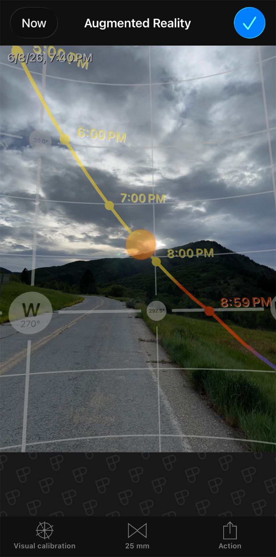
One of my favorite features is the augmented reality tool, which allows you to visualize the future position and path of the Sun, Moon, and Milky Way while you're on location. This is great for getting the composition ahead of time.
Other useful tools include sunrise, sunset, golden hour and blue hour information. There are also lots of helpful calculators. Two of the calculators I use frequently for things like long exposure shots with ND filters and timelapse photography. In the app you have the ability to save locations and photo plans.
For landscape photographers who like to carefully plan their compositions and lighting, PhotoPills can take much of the guesswork out of deciding where and when to shoot. If you feel overwhelmed by the sheer amount of ways to use the app, no worries, the photo pills team has loads of helpful tutorials and guides.

Clear Outside
A useful app for getting an idea of cloud cover and visibility conditions is Clear Outside. The app will take a little bit of getting used to, but once you’ve got the hang of reading it you’ll be able to understand conditions for an area better than you would just by looking at your phone’s standard weather app.
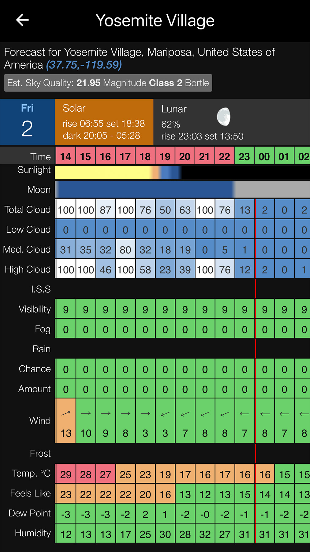
At the top of the app you’ll see layers for each of the different cloud types (low, medium, and high). Then you can see numbered and colored boxes for the different hours of the day. Both the color and the number on the box represent how obscured that layer of the sky will be by clouds. So a white box that says 100 would be complete cloud coverage on that layer.
As a landscape photographer, often you will be looking for no or very little low and medium clouds with some high clouds that can catch some color at sunset.
Clear Outside also includes things like fog, visibility, and the chance of rain.

Windy
Another great app for weather and cloud predictions is Windy. One thing that is nice about Windy is you can use the mobile app or access all the content on their website if you prefer a bigger screen.
Windy offers various layer overviews you can see on the map to check things such as thunderstorms, snow, and what I most use it for, clouds. There are countless other layers available as well. You can see each of these layers predicted over time.
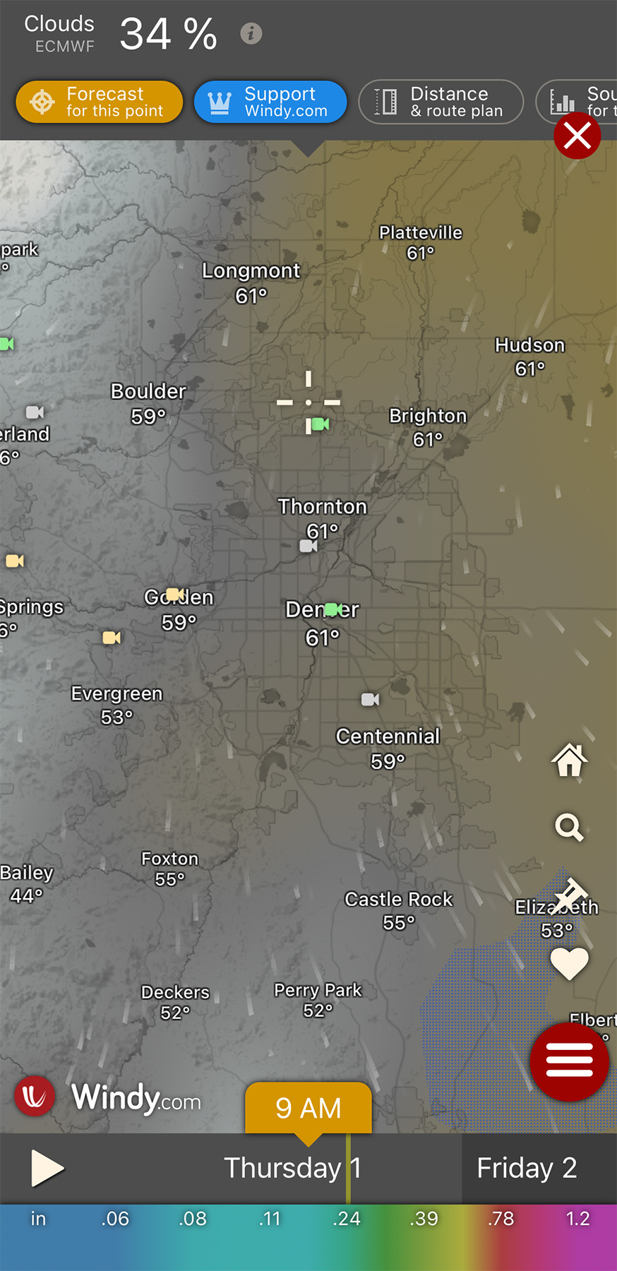
There is a low cloud layer and a high cloud layer. If you look for no low clouds but some high clouds you can get the ideal situation where the clouds are lit up at sunset or sunrise but the sunlight isn’t blocked by lower clouds. Because the layers are overlaid on the map, this app can also be useful to see what direction the clouds will be in and the direction they are moving.
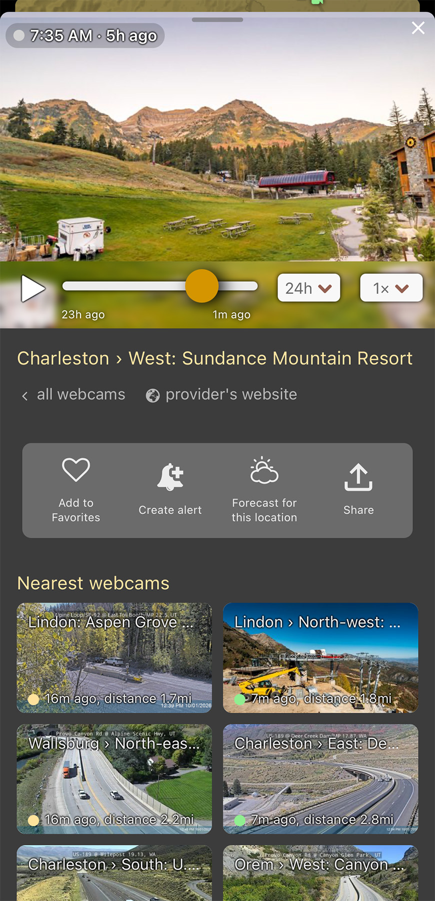
Another very underrated feature of Windy are the webcams. You can toggle on webcams and you will see little icons on the map wherever a webcam is available. You can click the icon and see live streams from the webcams. This can be a great way to check conditions in an area you may be interested in visiting.

AllTrails
If you are a semi-frequent hiker, you have probably already heard of AllTrails. However, as a photographer I don’t always use it in the way you might be thinking.
AllTrails is great for finding new hiking trails, checking trail conditions, and more. I use the app anytime I go hiking. It can be a great resource to find new spots and trails. I love the ability to see the trail on the map as I hike and keep track of how much distance I have left.
However, what I most use it for as a photographer is to check conditions of a specific spot by looking at the photos. If you find a trail or spot you want to check conditions for, you can click on the photos for that trail to pull up all of the images people have submitted. If you sort by the most recent photos you’ll often be able to see what the conditions are currently like.
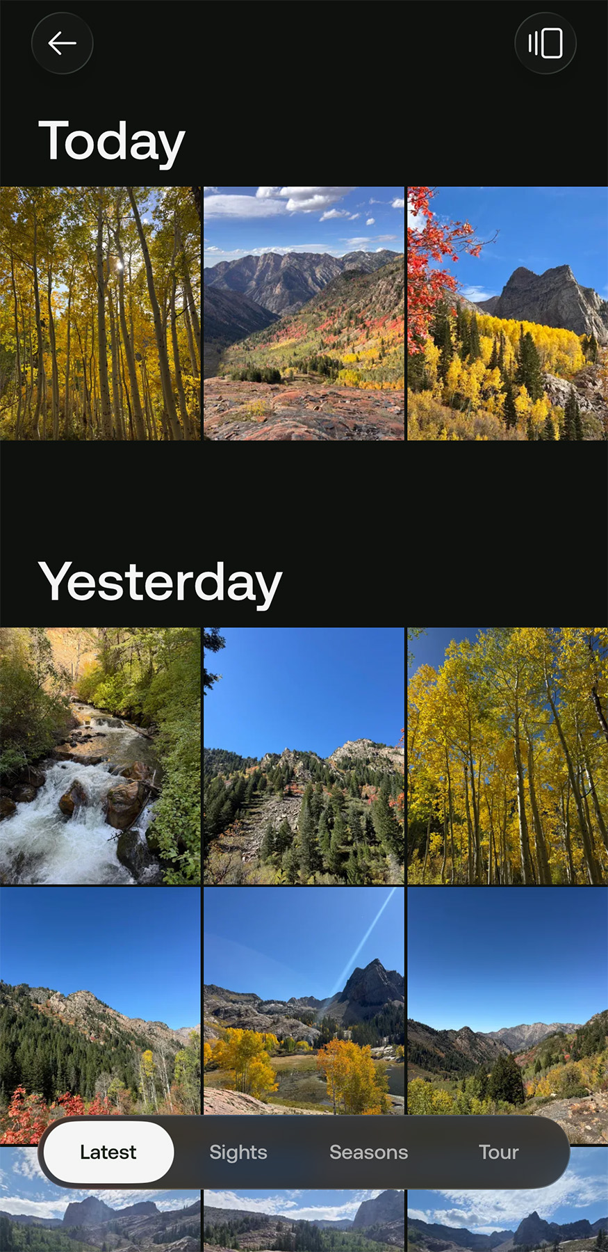
I use this to check things like wildflower blooms in specific spots, fall color timing, and more. The downside to this method of checking conditions is that it relies on photos to be submitted so if the particular spot you are interested in doesn’t get enough hikers submitting photos you may not be able to see anything recent.

Google Maps
If you want to find new locations, Google Maps can be an incredibly useful tool. Exploring the map can help you discover new places to take photos in the areas you’re interested in.
I always explore on Google Maps the areas I’m going to when I travel and there are always intriguing places that I find that are great photo opportunities I would’ve missed otherwise.
In Google Maps you can use the photos for a location or Google’s Street View to get an idea of what a location may look like. Sometimes you can also use the submitted photos, or even videos, to check the recent conditions. It is not as easy as AllTrails but sometimes a location will have a fairly recent photo or video submitted that gives you an idea of the conditions.
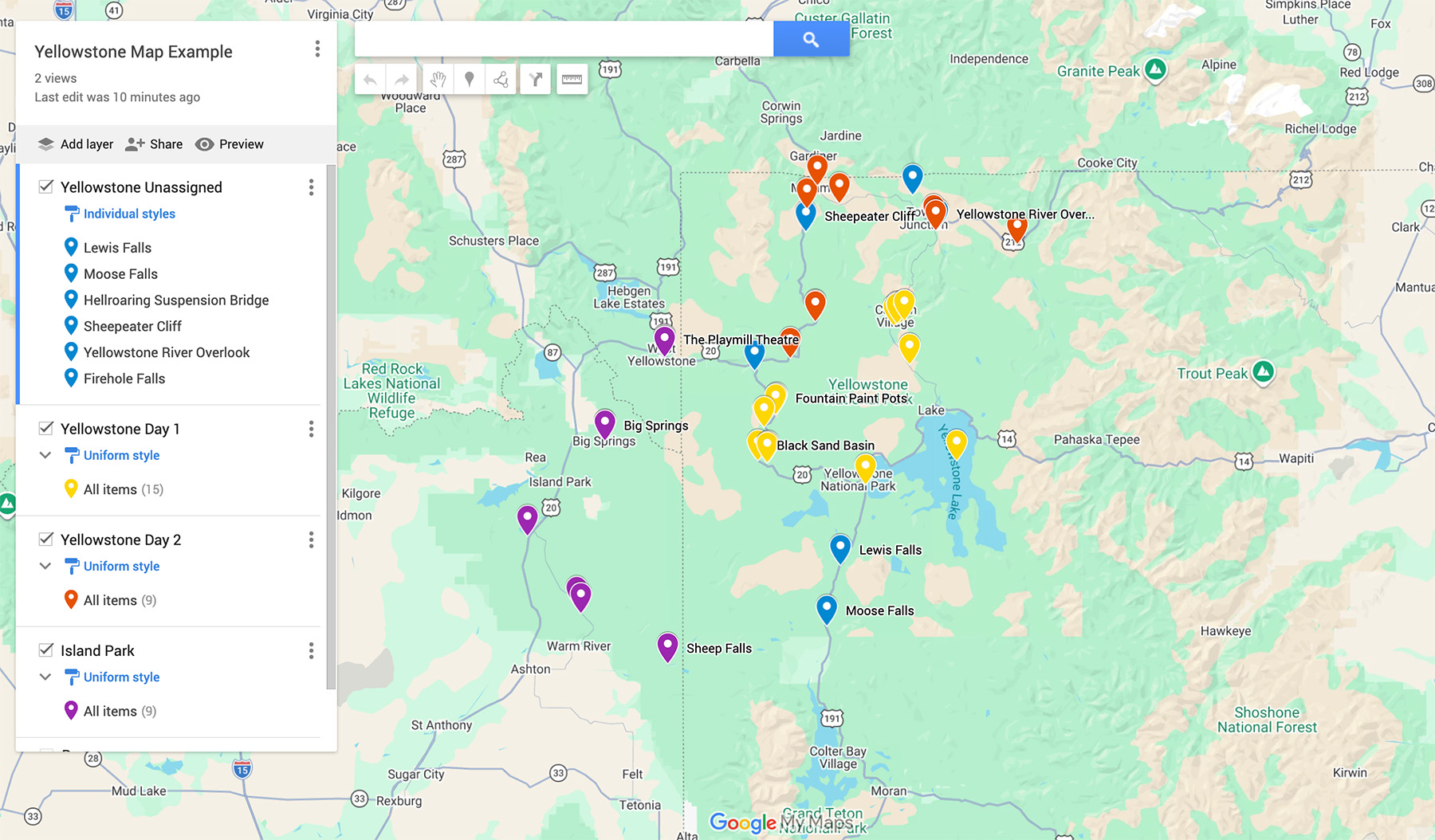
The most powerful feature of Google Maps that I don’t think gets enough attention is Google My Maps. Google My Maps lets you create your very own custom maps with Google Maps. You will need to create them on a computer but all you need is a Google account.
You have the ability to place custom pins, give them names, photos, and descriptions. You can even add driving routes too. The maps you create can be used on your phone on the Google Maps app and you can share them with others like you would any google drive file.
To see an example of a google my map click the following link: EXAMPLE GOOGLE MY MAP

Maps.Me
Another great maps app is Maps.Me. I include the app for a very specific reason: Maps.Me allows you to create custom points of interest, and more importantly, download and use maps offline for free.
Many times I’ve been shooting in locations with little to no cell service and with the use of Maps.Me I have been able to easily navigate and find my predetermined points of interest even when I don’t have a connection.
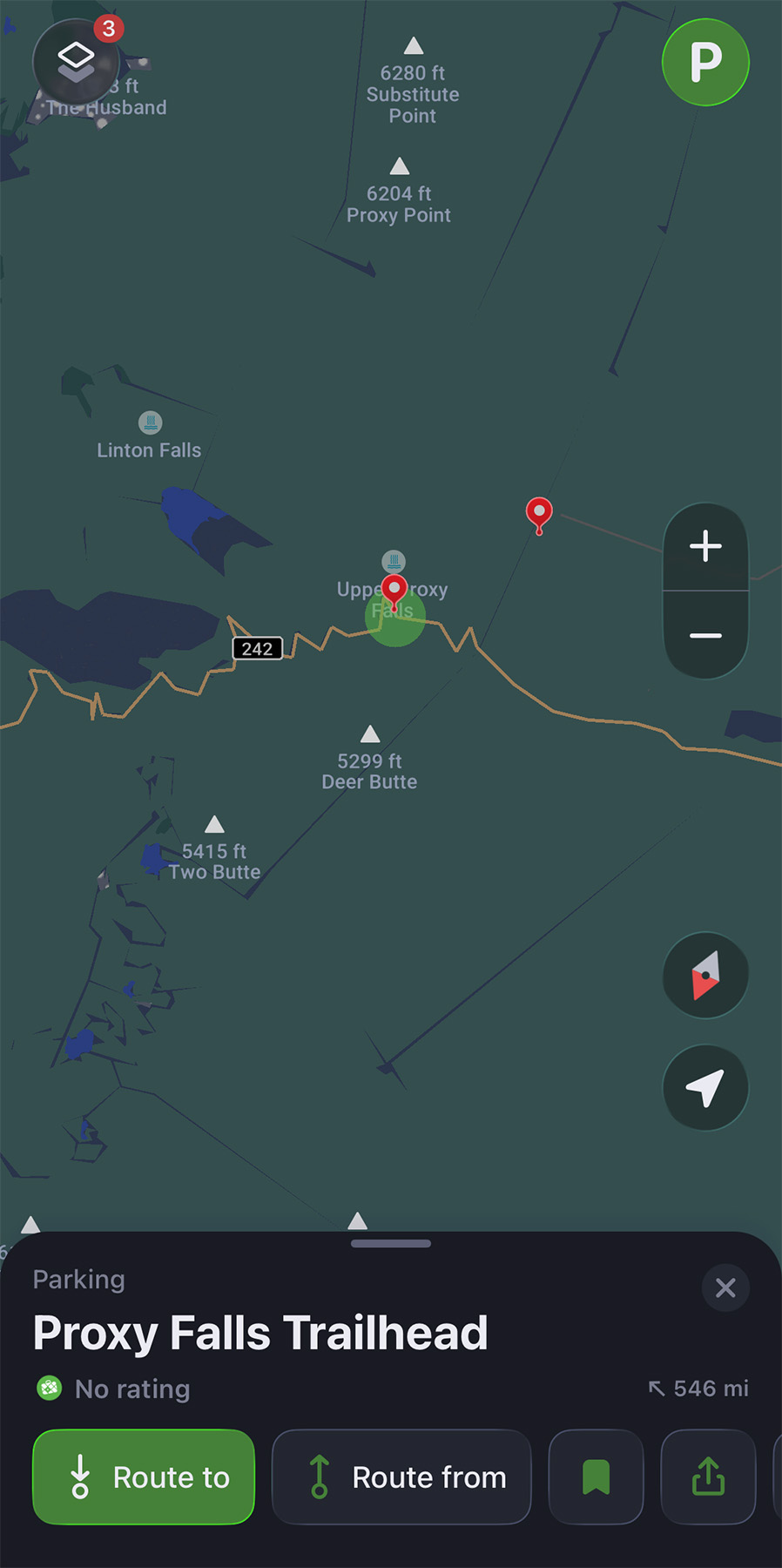
I highly recommend using Maps.Me with Google My Maps. Why? Google My Maps allows you to export your custom-created maps which you can then import into Maps.Me and use offline without any cell service.
You simply download the maps for the area you’ll be in for use offline and import your custom My Map from Google. Then you will be able to see your points of interest and navigate to them, with or without cell service.
To understand better how to export your Google My Map into Maps.Me click the following link: HOW TO IMPORT GOOGLE MY MAPS TO MAPS.ME
Conclusion
Getting the perfect landscape photo isn’t always about being in the right place at the right time. It’s about knowing where and when the right place and time will be. While no app can guarantee perfect conditions, these tools can help you eliminate a lot of the guesswork and give you a better chance of being prepared when those conditions do come together.
I use these apps regularly in my own landscape photography, and they have made planning my shoots much easier. Hopefully they can do the same for you and help you spend less time wondering “Will the conditions be right?” and more time actually capturing the images you’ve been hoping for.
I also have a full video breakdown of these apps, along with several others, available on my YouTube channel. If you have questions about how I use these apps or have another photography-planning app you think I should check out, feel free to reach out!